


After a long summer full of exhausting work we have achieved something very close to what we were looking for. Day by day improvements were implemented in the original software and tested in the afternoons on the real train; in a totally real situation. In the first days of each month it was very frustrating because the bugs were so significant forcing me to go back to the previous version in order to use the tool. The headaches caused by seemingly insignificant glitches combined with the unbearable heat led to many moments of doom and gloom. I guess there is always a reward for perseverance and in this case it consisted of a version that was solid and functional enough to launch a new deployment on Google Play.
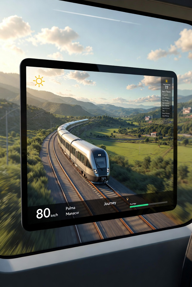
But, what changes have been important enough to talk about in this post? The most important of all is the trace tool: every 15 seconds the position of the active train is recorded and represented in the net diagram. Observing the track of the train allows you to understand the evolution at a glance, which means that it is easy to see if we are recovering time from a delay or if we are losing it.

No less important is the indication of estimated speed in the net diagram. A dotted line represents the trend of the train in the future. Reaching and keeping punctuality is as easy as operating the throttle so that this line points to the next segment beginning in the theoretical train mesh. The trace combined with the estimated speed line make a powerful combination that allows you to maintain perfect punctuality without having to do the math or even look up any numeric value.

But for those who also need to know the numerical values of everything that happens, I have incorporated a new speedometer that has also become the new image of Ónice. It represents three speeds:

- Current Speed (A): It is obtained from GPS.
- Limit Speed (B): It is the maximum speed allowed in that section. It is calculated by finding the minimum of the maximum speed of the line, the maximum speed of the train and the most restrictive speed limitation at that point. If the current speed exceeds the limitation speed, the speedometer changes color to red and if it exceeds the maximum speed by a certain (configurable) amount, an audible alarm sounds to warn the Driver to slow down.
- Objective Speed (C): It is the cutting speed that allows to maintain punctuality. Above this value the train will recover the delay time or increase the advance time. Below it will increase the delay time or decrease the lead time. It is represented in blue and when the current speed exceeds the target speed, it also turns blue, indicating to the Driver that time is being recovered. The target speed is calculated per leg between points on the route and depends on the distance to be traveled and the time allotted to travel it.
Next to the speedometer is the numerical representation of the most important value that this App can offer: The current delay time. It is a figure that is shown in red to indicate delay or in blue to indicate advance. The current delay time is a direct calculation based on the train’s schedule, the current position and the topology of the line. Being an independent value of the speed or the temporary drift of the train, it can be displayed at any time and is very precise. The objective of the Driver is to reduce this value when it is displayed in red and to avoid leaving any station with a figure greater than zero in blue.

Combining all this information with the map, the net diagram and the current speed restrictions a Driver can get a complete idea of where he is and how he should proceed to achieve optimal manual driving.
This version also contains operational improvements that make operation easier. The net diagram now allows zooming using intuitive gestures, as well as scrolling to see the other circulations involved in driving. Acoustic alerts have been added to draw the Driver’s attention especially in three possible situations:
Since the application is designed to be used while driving a train, the interface has been designed in such a way that it is easy to identify the information. A significant part of driving is done in twilight or dark conditions. In these cases there is a night mode without fatigue that allows you to maintain visual acuity after consulting the screen. Night mode can be activated automatically depending on the device’s dark mode settings, or can be swapped (or switched) manually immediately via a switch on the map view.


I still have a list of improvements and changes to make. I am very demanding with the software I develop and I am far from accepting this latest version as good, but I consider that it has been a great advance and that is why I decided that the best thing I could do was share it by uploading it to Google Play.
I hope you enjoy it and, if you can, tell me how you think I can improve it.